Network Rail are developing major proposals to upgrade the Brighton Main Line – one of the most congested routes in the country – to provide more reliable, faster and more frequent services on the line and its branches.
Key to the upgrade are proposals to remove the most challenging bottleneck on Britain’s railway network at the ‘Selhurst triangle’ and East Croydon station as part of proposals for the East Croydon to Selhurst Junction Capacity Enhancement Scheme.
To check out the plans, the Brighton consultation will be on:
Monday 10 and Tuesday 11 December 2018 - The Brighthelm Centre, North Road, Brighton, BN1 1YD, 4.00-8.00pm.
More details: https://www.bhep.co.uk/brighton-business-news/2018/12/4/unblocking-the-croydon-bottleneck-public-consultation-in-brighton
Showing posts with label railways. Show all posts
Showing posts with label railways. Show all posts
Thursday, 6 December 2018


Friday, 16 September 2016
Station steps

The design of these steps on one of the main access routes to the station leaves much to be desired. They are precipitous, wide without a central hand rail, have only one landing and are poorly lit at night.
Also, as can be seen from the photo in bright sunshine, the lips of the treads are hard to pick out. This could lead to a catastrophic stumble, especially for people with poor eyesight. In well-designed stairs contrasting strips are incorporated along or near the edges of the treads.
We could surely have hoped for something better on what is an important pedestrian route to the station for many people.
Monday, 20 July 2015
Friday, 20 February 2015
Brighton Station gateway - latest

Work has now begun on the final phase of the Gateway scheme which is scheduled for completion this summer. Between now and then work will progress east to west through the area, beginning with the taxi rank area in the east.
From Monday 23rd February the area around the taxi rank approach road will be resurfaced. Between 23rd February and 6th March no southbound traffic will be permitted on Terminus Road from Bath Street onwards and diversions will be in place for southbound through traffic from Seven Dials. During this time a temporary rank will operate from Terminus Road, on the western side of the station.
Subsequent work entails:
Re-paving the entire area using high-quality UK-sourced stone.
Installing new lighting
Providing improved bus stop facilities.
Enhancing the sense of place though seating, greenery, and street furniture.
For the duration of the works southbound traffic will not be permitted south of Trafalgar Street / Guildford Road.
Friday, 8 August 2014
Two Blue Plaques for Brighton Station
Unveiled today, two new plaques are now adorning the interior of Brighton's splendidly refurbished Victorian station.
Firstly, in the presence of the Deputy Mayor Cr Denise Cobb, a plaque to David Mocatta the station architect was unveiled by members of his descendant family.
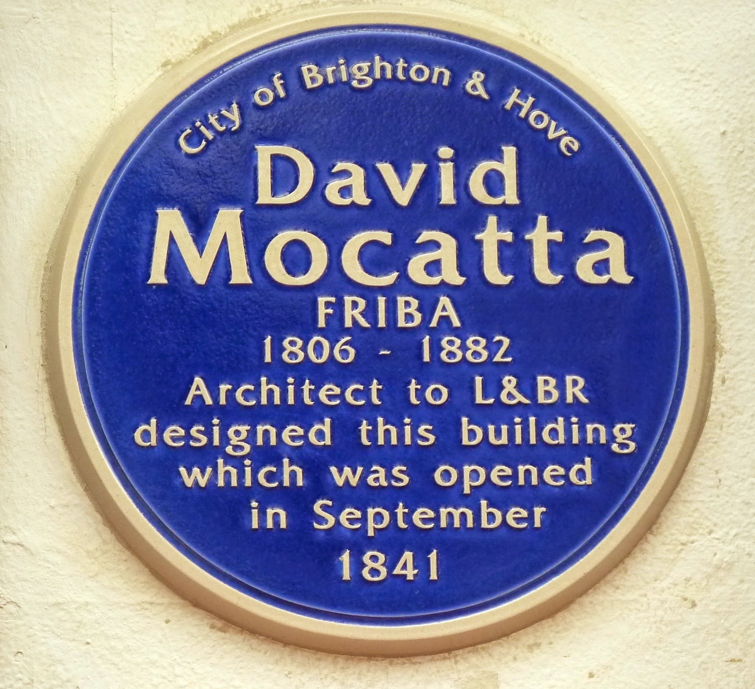

Firstly, in the presence of the Deputy Mayor Cr Denise Cobb, a plaque to David Mocatta the station architect was unveiled by members of his descendant family.
 |
Secondly, a new plaque to John Saxby, who did early vital work on railway signalling, was unveiled by his descendants.
 |
| Add caption |
In connection with this plaque, tribute was paid to the late Bill McIlroy who campaigned for several years for the replacement of a pre-existing plaque to Saxby. This was of grey slate in a nearby poorly-lit passage and with lettering very difficult to decipher.
 |
| The old plaque to John Saxby |
The new plaques were promoted by the City's Commemorative Plaque Panel and financed by Southern Rail who manage the station.
Saturday, 17 August 2013
The petty annoyances of rail travel
 |
| Click on image to enlarge |
The challenge is to find any difference in the journey offered except the price.
Thursday, 18 July 2013
Cycle 'hub" for Brighton Station

Plans for a 3-storey Cycle Hub in Mangalore Way have been approved by the Planning Committee. (Application no. BH2012/03872). It will be built above the embankment shown in the photo above with a floor for secure cycle parking level with the Station concourse above. 420 extra cycle spaces will be created.
On the top floor will be showers, changing rooms, a cafe and a north-facing terrace. Also at the north end will be stairs and a lift large enough to hold a bike or a wheelchair to give access to the station concourse from Mangalore Way.
The application also mentions re-opening the staircase shown in the photo but it is not made clear where this will lead to.
 |
| Views before & after looking south at concourse level. |
Saturday, 6 July 2013
Wednesday, 26 June 2013
The New England Inn

The New England Inn (latterly the Cobbler's Thumb), although neglected and unsympathetically painted, forms a historical and harmonious pairing with the listed goods bridge in the background and is still an elegant adornment of an important corner. It was the public house of choice for hundreds of the railway workers who passed it on the way home from work to their nearby purpose-built dwellings. It is ironic that, while the goods bridge awaits a long planned "ghost train" sculpture to commemorate the past industry of the area, a still-standing memento of the era is scheduled for demolition.
The building is owned by the Council and on 21 May 2013 they submitted planning application BH2013/01664 for prior approval to demolish the building on the grounds that it had become unsafe. From a casual inspection this seems surprising. The pub has only been closed a few years and the roof appears sound and all 4 walls stand square and intact. The only sign of deterioration is associated with a later extension on the south side. These extensions often tended to be jerry-built and in this case its foundations appear to be failing and the masonry is pulling away from the original wall. One would think this could be easily rectified by demolishing the extension. The building could then be renovated and converted to several flats as has happened to public houses elsewhere in the City.

As seems to happen all too often the Council is defaulting to a simplistic solution without proper consultation. The decision on the planning application was that prior approval was not needed, so the fate of the building still hangs in the balance. Representations have been made. The Council should surely think again.
See also:-
"Locomotive" art work for Greenway bridge.
"Ghost"-train chugging closer . . .
The Greenway bridge 'locomotive' - update
Monday, 12 November 2012
Station gateway - update

Brighton Station is the gateway for thousands of people to the city every day yet, for the pedestrian, the exit routes, as existing at present, are not exactly convenient or welcoming. Leaving over the Trafalgar Road bridge the pedestrian is confronted by bus lanes; leaving at the west end (near end in photo) one is immediately confined to narrow pavements and, to proceed in any direction but down Trafalgar Street, presented with the need to negotiate heavy traffic.

It appears that taxis after queueing from south to north in Frederick Place and up the south side of Trafalgar Street, outside the forecourt in what was the nearest bus lane.
The listed canopy, added in 1882, casts an unfortunate gloom over the forecourt, especially at the far eastern end, where also the windows over Trafalgar Street are, inexplicably, too high to allow a view over Brighton. Council planners are investigating opportunities with English Heritage and the Railway Heritage Trust to replace, reduce or improve the existing canopy in front of the station to let more light into the area.
Rail partners are considering a plan to reopen a pedestrian entrance between Trafalgar Street and the current taxi area (the entrance on Trafalgar Street is currently blocked by an electricity substation). It is hoped an entrance can be reopened soon, along with a lift to ensure accessibility for all.
The current designs being considered by Brighton & Hove City Council have been shaped with public feedback to give as many people as possible a chance to be involved. The deadline for commenting on the proposals is Friday 30 November. To comment go to: http://www.brighton-hove.gov.uk/index.cfm?request=c1255734
The next stage in the process is for all feedback and the plans to go to Transport Committee in January for approval to continue to the detailed planning stage. If approved, work may be able to begin in early 2013.
Earlier Posts:-
Brighton station gateway
Brighton station gateway 2
Station staircase may be reopened
New proposals for Brighton station gateway
Sunday, 23 September 2012

Friday, 10 August 2012
The Brighton station clock . . .

. . . . . has gone, and is greatly missed. Not simply because it is a wonderful object in its own right, which it is; but because we all knew exactly where to look for it and absorb the time with the minimum of delay and visual difficulty. The alternative digital display on the electronic departure board is difficult to locate amongst all the other information provided; and, of course, a digital read-out provides no analogue indication of the time to train departure.

This Victorian clock dates from the days of the London, Brighton & South Coast Railway. One hopes it has just gone for maintenance and its return will not be long delayed.
Tuesday, 11 October 2011
Work on the London Road Viaduct
In planning application BH2011/02884, Network Rail describes a number of defects on the London Road viaduct on the section between the Preston Road and Beaconsfield Road. The condition of the viaduct is said to present a safety hazard to the retail premises and members of the public below.

The businesses below are to be relocated while the remedial work is carried out. The work proposed seems quite extensive and includes; removal of vegetation and treatment of the roots, the replacement of missing, spalled or loose bricks and pier corbels, stitching of fractures, repointing, repair of cornices and the installation of lead flashings.

The arches involved stretch from the east side of Preston Road to the west side of Beaconsfield Road. Presumably Network Rail has to prioritise its maintenance programme. The crop of greenery seen here is just outside the zone and will evidently survive for the time being . . .
See also: The London Road Viaduct

The businesses below are to be relocated while the remedial work is carried out. The work proposed seems quite extensive and includes; removal of vegetation and treatment of the roots, the replacement of missing, spalled or loose bricks and pier corbels, stitching of fractures, repointing, repair of cornices and the installation of lead flashings.

The arches involved stretch from the east side of Preston Road to the west side of Beaconsfield Road. Presumably Network Rail has to prioritise its maintenance programme. The crop of greenery seen here is just outside the zone and will evidently survive for the time being . . .
See also: The London Road Viaduct
Friday, 2 September 2011
Fares protest at Brighton Station

Caroline Lucas, Brighton Pavilion MP and leader of the Green Party, joins a protest against fare rises at Brighton Station this morning.
Saturday, 11 June 2011
Hove Station footbridge

The recent refurbishment of Hove Station, which included the installation of glazed panels to the canopies, has produced a great improvement in station users' experience. However, it has thrown into even sharper relief the shabby state of the pedestrian footbridge, which still seems to flourish the grime of the age of steam. One wonders, in fact, if it has ever been cleaned and repainted in the 100+ years of its existence.
There are periodic calls for "something to be done", the latest in February by Green councillor Alex Phillips, and the Brighton & Hove Green Party has set up a petition which to date has received just 14 signatures. The maintenance of the Grade II listed, victorian footbridge, which is a public right-of-way, is in fact the responsibility of the City Council. It will be interesting to see how the Greens, now that they are the largest party on the Council, intend to respond to their own petition.
One can see the difficulties. Although it is a public right of way, the exterior of the bridge can only be accessed from Network Rail property, and that with difficulty. It will not be a quick or cheap undertaking but it will surely need to be tackled soon.
Friday, 6 May 2011
Hove Station - then & now

The Italianate-styled nearer building dates from 1865 when the station was called Cliftonville after the area that was being developed south of the coastal railway line and west of Brunswick Town. There was already a station called "Hove" on the Brighton-Shoreham line at Holland Road. In 1879 the "Cliftonville spur" was built which connected the coastal line with the main London-Brighton line without the need to go into Brighton Station. In 1893 the further red-brick building was erected and the name of the station changed to Hove.

2011. Very little has changed over the succeeding 100 or so years, except the local transport. The nearer building has lost its canopy and is no longer in station use. The distant building is still the ticket office. Hove Railway Station including the footbridge, is Grade II listed.
Tuesday, 20 July 2010
The Station Site
Apart from a plot at the southern end the station site is now all built up and we have the depressing towers, windy canyons and unfriendly pavements everyone feared from the planning application. Yet the single, people-friendly feature that was promised, the Greenway, is still not fully open. This view below is taken through the barrier less than halfway along the path towards New England Road.


The Greenway, at present running between Stroudley Road and New England Street, is intended to be accessed via steps on the north side of New England Road which it then crosses on the disused goods bridge. It then follows the path of the old goods line to just below the Jury Inn. It is good that the brick pillars which supported the line have been retained. The last part of the Greenway from Stroudley Avenue to the station is yet to be constructed.
This goods line originally terminated at Trafalgar Street 30ft below the station platforms. This was in fact the second goods line to be constructed, the first was accessed from the Shoreham line and passed in a tunnel (still there) under the station platforms.
A photograph of part of the site as it used to be may be viewed here.
Saturday, 10 July 2010
Shoreham Airport - 100 years of flying

The Art Deco terminal building by Stavers H. Tilman is Grade II* listed and has appeared in "Tenko", as Singapore airport, in "Fortunes of War", (the excellent dramatisation of the Olivia Manning novels which featured Emma Thompson and Kenneth Branagh), and in "The DaVinci Code". The terminal is situated right alongside the coastal railway line and once had its own station. In 1937, 6000 passengers used the airport but, because of the short runway, which there is no prospect of lengthening, it cannot accomodate the size of aircraft now needed for commercially viable passenger business. Modern use is restricted to private aircraft, flying schools, sight-seeing flights and helicopter and light aircraft maintenance and sales. It is also the headquarters of the Sussex Police helicopter.
Tuesday, 23 March 2010
Railway Lines

A view from Burton Walk. The bridge carries the Old Shoreham Road: further on the entrance to the tunnel under Dyke Road can be seen.
Subscribe to:
Posts (Atom)