Showing posts with label travel. Show all posts
Showing posts with label travel. Show all posts
Sunday, 28 April 2019


Wednesday, 27 March 2019
Wednesday, 26 December 2018
Toad's Hole Valley proposals
 |
| Illustrative master plan |
An outline planning application BH2018/03633 for the development of Toad's Hole Valley has been filed. It proposes: 880 much-needed dwellings; a secondary school; office/research/light industry units; a doctors' surgery community building, and public open space (including for food growing and play space).
It also includes enhancements and alterations to the Site of Nature Conservation Interest to the east of the site and associated landscaping.
The most controversial proposal seems likely to be the suburbanisation of King George VI Avenue. Nearly all A23, A27 traffic destined for Hove and Portslade funnels down this road. The 3 light-controlled vehicular accesses is a welcome reduction from the 7 suggested earlier for the development. This will still result in some rush hour delays but in the search for new housing maybe this is just one of the trade-offs the city has to accept.
The most controversial proposal seems likely to be the suburbanisation of King George VI Avenue. Nearly all A23, A27 traffic destined for Hove and Portslade funnels down this road. The 3 light-controlled vehicular accesses is a welcome reduction from the 7 suggested earlier for the development. This will still result in some rush hour delays but in the search for new housing maybe this is just one of the trade-offs the city has to accept.
Comments can be filed up until the application goes before the planning committee in the spring.
Monday, 5 November 2018
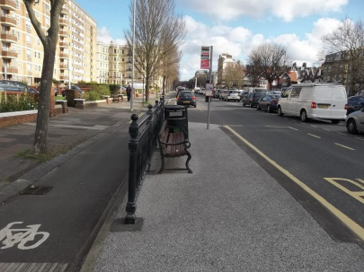
New bus shelters.
The city is to get 5 new bus shelters at sites prioritised according to the exposure to weather, distance from any other shelter, and number of requests from the public.
The estimated cost is £550,000 which is over £100,000 each. It seems on the high side for a fairly basic, largely refabricated, structure, but I suppose there are reasons . . .
 |
| Warren Road, top of Bear Rd. |
 |
| Warren Road, top of Wilson Av. |
 |
| Grand Avenue, Kings House |
 |
| Stanley Deason Leisure Centre, Wilson Avenue |
 |
| New England Rise. |
Thursday, 18 January 2018
City gets more cycle stands
 |
| Last autumn 74 stands were installed in the Hanover/Elm Grove zone |
The city council has just started a last phase for 2017/18 which will see stands installed for 124 bikes, mainly in central Brighton & Hove. Among 10 locations are Western Road, West Street, The Level and Palmeira Square. Two hundred new cycle parking spaces will have been installed in central Brighton & Hove by the end of this financial year.
Since 2006 the council has installed parking for almost 2000 cycles.
Anyone can submit suggestions for locations for cycle stands using a form on the council website www.brighton-hove.gov.uk/cycleparking. New requests will be considered for the 2018/19 financial year.
Abandoned bikes occupying racks – or anywhere else - can be reported on 01273 292929.
Cycling to work across the city doubled between 2001 and 2011 according to the census. Just under five per cent of its population cycle to work. Nine per cent of adult residents cycle at least once a week.
The local BTN Bikeshare scheme, launched last September, is reportedly the UK's most-used outside London.
Tuesday, 26 December 2017
Sunday, 17 September 2017
North Street closure
North Street is going to be closed to through traffic from tomorrow, Monday 18th September until the middle of November.
All buses will be re-routed via King's Road and West Street.
It was last dug up in 2007 for renewal of Victorian water mains and apparently not reinstated properly.
The work is being done in 3 phases starting at the Clock Tower.
All buses will be re-routed via King's Road and West Street.
It was last dug up in 2007 for renewal of Victorian water mains and apparently not reinstated properly.
The work is being done in 3 phases starting at the Clock Tower.
Phase 1
 |
| Queen's Rd. to King St. |
Phase 2
 |
| King St. to Bond St. |
Phase 3
 |
| Bond St. to East St. |
Monday, 10 July 2017
First BikeShare docking stations
 |
| East of the Palace Pier. |
Between now and early September 50 bike share docking stations are being installed around the city. Their locations are:
Imminently:
- Brighton Centre (Odeon cinema)
- Brighton Palace Pier (seafront)
- The Grand Hotel (seafront)
- Hove Lawns Café (seafront)
- Madeira Drive (Yellowave)
- Metropole Hotel (seafront)
- Peace Statue (seafront)
- Brighton Station (Surrey Street)
- Edward Street
- George Street (Hove)
- London Road (opposite Baker Street)
- New England Street (Sainsbury's supermarket)
- Old Steine
- Preston Park (Preston Road)
- Seven Dials (Vernon Terrace)
- St James Street (Kemptown)
- Hartington Road
- Hove Town Hall
- Western Road
Locations for the rest of the 50 stations will follow.
The scheme is operated by Hourbike for BTN BikeShare in association with Life Natural Spring Water. It will offer 450 smart bicycles with built-in GPS and wireless capabilities. Users will be able to locate and rent “Life Bikes” locked in any location across the city via an app, or online. Riders can return bikes to any docking station or lock them up at any legal location around the city.
Brighton & Hove is the first UK city bike scheme to feature Sobi smart bikes, a high-tech brand used in New York, Portland and Santa Monica. Other local businesses are now being invited to sponsor the bikes with packages ranging from £5k to £50k.
The scheme is operated by Hourbike for BTN BikeShare in association with Life Natural Spring Water. It will offer 450 smart bicycles with built-in GPS and wireless capabilities. Users will be able to locate and rent “Life Bikes” locked in any location across the city via an app, or online. Riders can return bikes to any docking station or lock them up at any legal location around the city.
Brighton & Hove is the first UK city bike scheme to feature Sobi smart bikes, a high-tech brand used in New York, Portland and Santa Monica. Other local businesses are now being invited to sponsor the bikes with packages ranging from £5k to £50k.
Tuesday, 4 July 2017
Traffic delays at Marine Gate.

To enable this work lanes will be temporarily narrowed along the A259 from next week.
Since 2010 there have been eight casualties from accidents at the spot. A particular problem is stationary buses blocking pedestrians’ views of the road as they try to cross towards a central island.
This changes will also help guide cyclists from the cycle track on the southern side of the A259 towards other nearby cycle routes into east Brighton.
Monday, 12 June 2017
New cycling map

The map is aimed at local cyclists wanting to know more about recent cycling improvements, and visitors looking for things like cycle hire and repair, traffic free routes or rural rides on the city’s downland fringe.
Map users can select the area they want to cycle in and look for the type of route they prefer. They can also add landmarks, street names, cycle parking, light-controlled crossings, cycle shops and repairs. Many more features suggested by local cyclists have been included.
There is also an option to print or save a copy of a customised map and to add notes.
 |
| Some cycle lanes. |
The map will be updated regularly to include new features, such as the city’s forthcoming cycle hire service – due for launch in September.
The map can be found at www.brightonandhovecyclemap.co.uk
Wednesday, 7 June 2017
Temporary car-parking changes at RSCH

From Monday 12th June until Sunday 25th June the normal route to the multi-storey car park, from Bristol Gate across the hospital site, will be shut. This is to allow the delivery of large modules for a new building in the hospital.
During this period drivers should follow the signposted route (shown in blue on the image above) to reach the hospital’s multi-storey car park.
To help manage traffic during this period:
- The bottom of Whitehawk Hill Road will be made one way (from north to south), as shown in red on the image below.
- Parking bays next to the hospital on both Upper Abbey Road and Whitehawk Hill Road will be suspended.
Wednesday, 26 April 2017
Improvements at bus-stops

Marine Drive - Marine Gate, westbound
Kingsway - Westbourne Villas, eastbound
The Drive - Upper Drive, southbound
Eastbourne Road
Ditchling Road - St Matthias Church, southbound
Dyke Road Avenue – Hillbrow, southbound
Western Road – Clarence Square, westbound
Portland Road – School Road, westbound
Mile Oak shops, southbound
Fleet Street
Manor Road – Bristol Gardens
Valley Drive – Whitehorn Drive, southbound
Old Shoreham Road – Hove Park Villas, westbound and eastbound
North Road – North Laine
Whitehawk Road – Findon Road, southbound
Davigdor Road – Lyon Close, westbound
Portland Road – Coleman Avenue
The cost of over £200,000 has mainly come from property developers who negotiate contributions with the council planning department to pay for local improvements – called Section 106 agreements.
It is expected the new signs will be working by the end of August. They will complement 180 already operating citywide..
Bus-stop parking restrictions
Parking restrictions at 11 bus stops will be beefed up to stop selfish drivers blocking access to buses for people with mobility problems. These make any driver pulling up in a bus stop liable to a £70 fine. Consultation letters to locals are going out this week.
The proposed locations (street, bus stop, direction) are:-
Bexhill Road - Balsdean Road southbound and northbound
Bolney Road - already completed
Hangleton Way eastbound
Hodshrove Road
Poplar Avenue - Sherbourne Road
Carden Hill - Rotherfield Crescent southbound
Sherbourne Road - Sherbourne Close southbound
Hangleton Road - The Twitten northbound and southbound
West Way Twitten, westbound
Friday, 21 April 2017
Road changes at the RSCH: 22 & 29 April

On Saturdays 22 and 29 of April the service road that leads to the County Hospital’s Multi-storey Car Park will be closed at its east end between 2pm and midnight. This is to allow preparations for a new building that will stand beside it. The road has to be dug up as part of these preparations.
Vehicles for the car park, the Children’s Hospital, the Millennium Wing, the Sussex Kidney Unit and the Thomas Kemp Tower should use Upper Abbey Road and Whitehawk Hill Road to enter and leave the hospital. These roads are on the west of the hospital. Please download this map to help reach the correct entrance.
RSCH site map showing alternate vehicle routes - 22 & 29 April
Vehicle access to the Emergency Department (A&E) will not be affected by the works.
Friday, 3 March 2017
Friday, 3 February 2017
Thursday, 17 March 2016
Sunday, 28 February 2016
How Brighton Station was saved.

To Letters Editor, Civic Brighton platform
In the no. 112 Scenic station in the series ‘Brilliant Brighton’ (Argus 24.February) the writer has made a series of mistakes
The final sentence reads: “The plans to demolish [Brighton] station in the 1970s and replace it with a hotel helped rally Brighton’s Regency Society which went on to save North Laine and countless other buildings.“ The then secretary of the Regency Society, Anthony Dale, considered Brighton Station to be an ugly building and not worth preserving.
It was then that the Brighton Society (not the Regency Society which had been formed soon after World War 2), was formed and was successful in getting the station listed, which is why you see such a handsome building today. Another group which was active in saving the station was SOS (Save Our Station) who demonstrated that the plan to cover the site with a major office development was in fact illegal.
I am not aware that the Regency Society played any role in saving North Laine, which was threatened by a major overhead motor way. In those days the Regency Society was only interested in saving what they considered to be grand buildings.
no 59 in ‘Brilliant Brighton’ states that ‘Brighton councillors may have built terrible tower blocks . . . but the poverty in central Brighton . . . was terrible’. How does building tower blocks cure poverty, poor conditions perhaps, but not poverty?
It is worth noting that the tower blocks on Albion Hill do not house any more people than the terrace houses they replaced. Shortly after the tower blocks were built they were considered unsuitable for children. The Hanover area was next on the list for wholesale demolition, but today it is a much sought after area in which to live.
Selma Montford
Hon Secretary The Brighton Society since 1974
Thursday, 10 December 2015
Station View

Looking east from the station forecourt is a great view that is denied to most people. This 1960s photographer must have been very tall or standing on a box.
On the left is the British Rail Goods Depot. This was built out on a platform to be level with the incoming goods line below the main station. The goods line is now submerged by the New England Development although the Greenway follows its route for a short section south of New England Road.
On the other side of Trafalgar Street is Bernard Luper, tailors, and a small corner of the Unique Garage, now 'Thrifty', a car rental business.
In the distance, beyond St. Peter's Church is the massed mid-19thC housing, built largely for railway workers; now known as Hanover and much sought after.

 |
| Looking west up Trafalgar St. |
Sunday, 1 November 2015
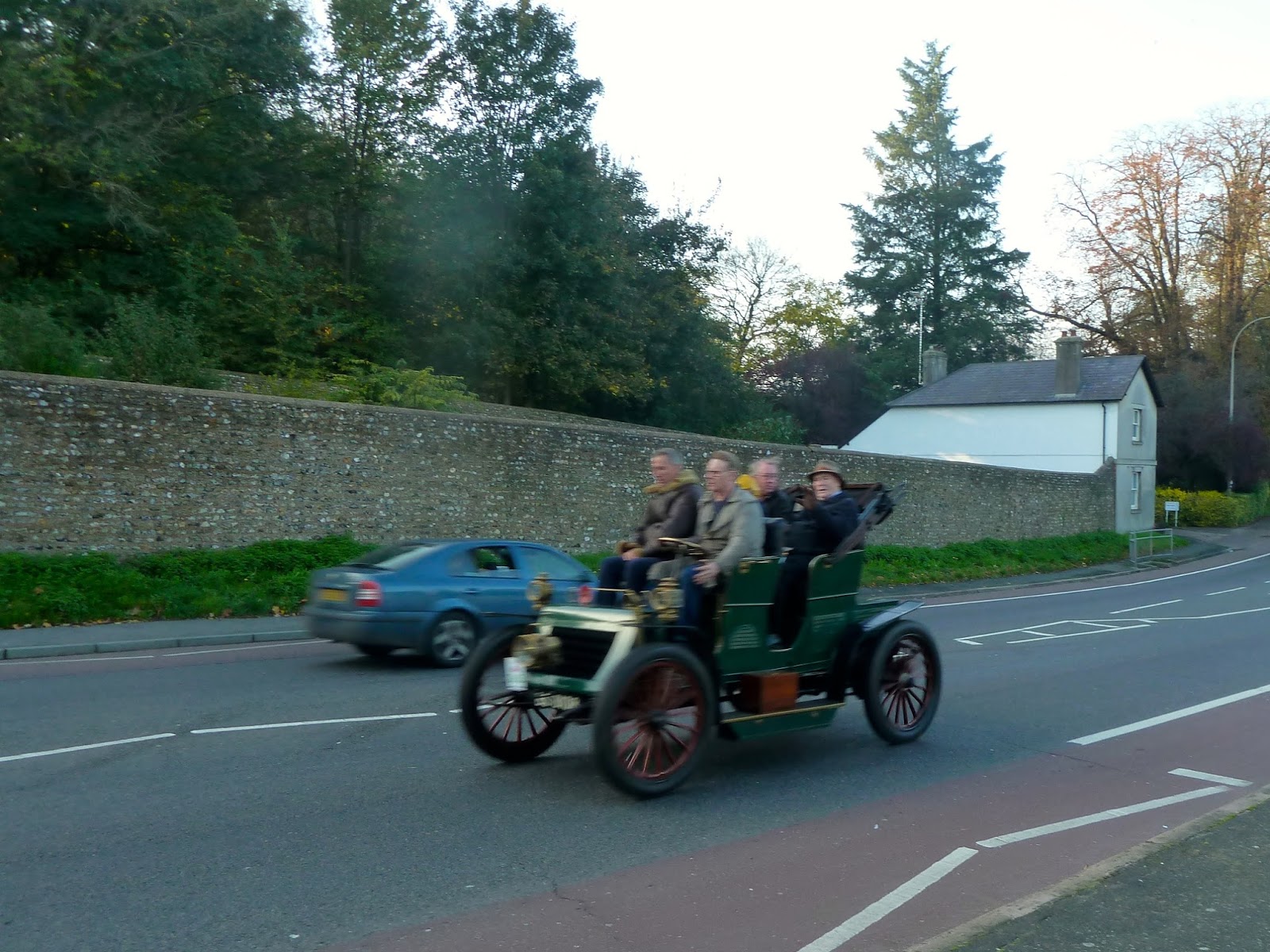
Veteran Car Run 2015
It was brilliant weather for the 119th anniversary of the first run in 1896.
Some of the entries. 57 miles down just 3 to go . . . .


Some of the entries. 57 miles down just 3 to go . . . .




Friday, 24 July 2015
Valley Gardens vacillations

It seems as if the new Council, desperate to meet pre-election promises to revisit the Valley Gardens plans, have lit on the lack of information on weekend/holiday traffic. This has given them the excuse to put the project on hold while they commission a report. But it is difficult to see exactly what information could turn up that we don't already have. This was probably the line taken by the original planners. It is a matter of simple observation that on many weekends or bank holidays the route is at saturation level with traffic queuing all the way back to Patcham and beyond.
The bulk of holiday/weekend traffic can only get into Brighton one vehicle at a time because of the deliberately introduced “throttle” at Carden Avenue. It is then single lane all the way to Stanford Avenue. It is evident that capacity is limited by factors outside the Valley Gardens area and at peak times it is unavoidable that traffic will be queuing, sometimes north beyond Patcham roundabout.
Valley Gardens is about 0.5 miles long. From Old Steine to Patcham is about 3.5 miles. The effect of reducing the traffic to a single lane along the east side of Valley Gardens, will be to add a maximum 0.5 miles to the north end of any queue. On peak traffic days, when the traffic is queueing to Patcham, it lengthens the queue by just 14% but the exhaust pollution along the Valley Gardens is halved and the vehicles displaced to the end of the queue are exhausting fumes into much more open, less inhabited, surroundings than exist along Grand Parade and Richmond Place.
It is difficult to see that extra traffic reports can produce substantially different conclusions. What the Council must be hoping is that a possibility for some minor tweak is discovered, so allowing them to save face and proceed with
a scheme that basically seems the best that can be achieved under the circumstances.
Subscribe to:
Posts (Atom)